Cracking Views while Running the Cumbria Way
This is what makes trail running so compelling: the beautiful scenery you get to run through. Steph Scott enjoys cracking views on the Cumbria Way.
Cracking Views while Running the Cumbria Way
https://www.contoursrun.co.uk/cracking-views-on-the-cumbria-way
With thoughts of a new race in mind, I set out to explore the Cumbria Way with an ultra-running friend of mine. The prospect of yet another easy-to-access trail was very exciting and also interesting, as I was keen to investigate the underfoot conditions and the technicality of the route. I was particularly keen to experience the 30-mile section from Keswick to Carlisle, as this would form the race route. I also need no excuse to head to Keswick, so off we went with our running rucksacks full of food, drink and appropriate wet weather gear, as the Lake District was keen to demonstrate that summer was over!
Heading up Spooney Green Lane to Latrigg car park is a challenging but pleasant start, and is a route that I know well from many lovely days (and nights!) spent on these fells. The path is good underfoot and the car park gate leads onto the grassy fell side. The Cumbria Way follows a clear path alongside a wall and weaves its way across a small water crossing and onto more challenging, rocky terrain, where the views along the valley offer a good excuse to stop and admire them.
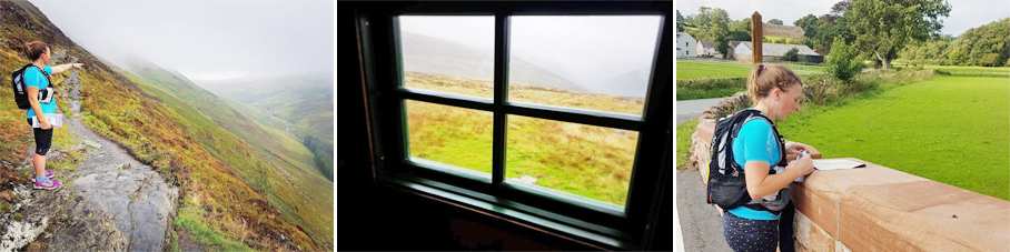
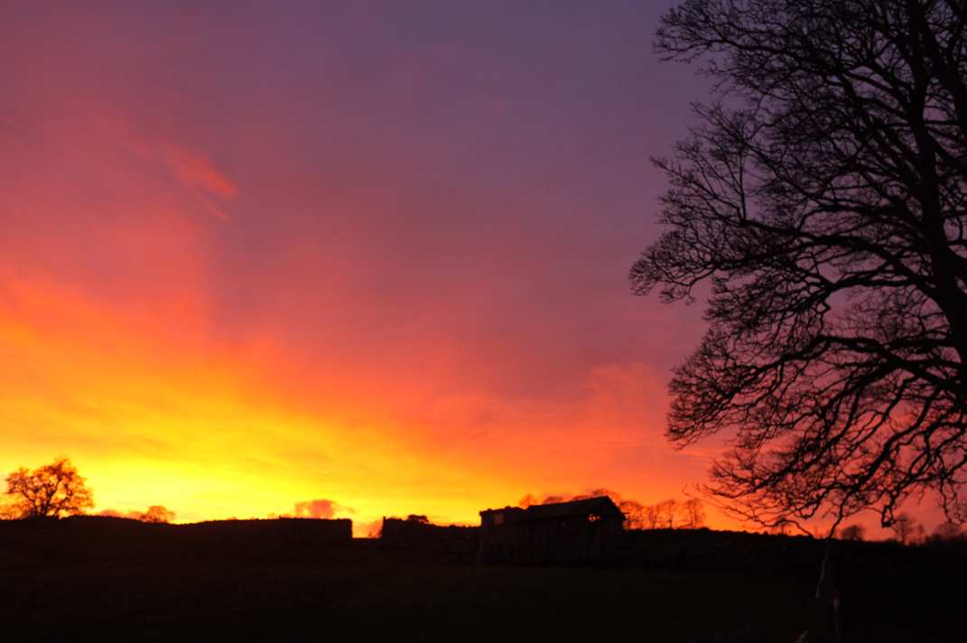
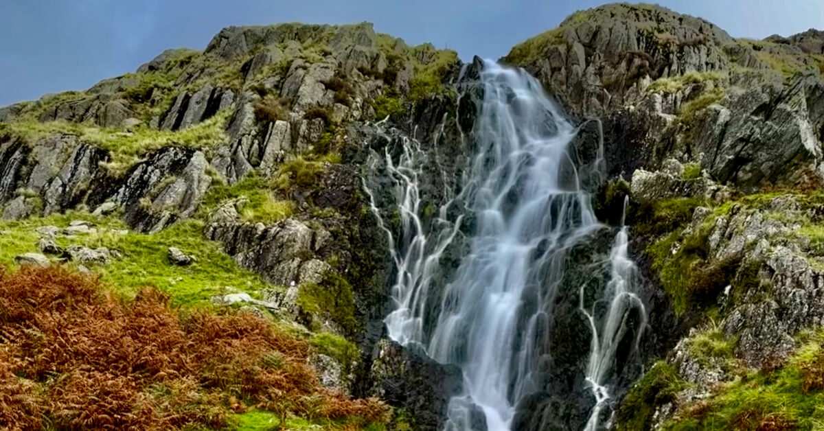
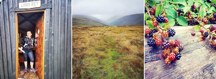
This is the most technical section of the route and, although the path is well-defined, care with foot placement is required. The path then starts to climb gradually past some old quarry ruins and heads towards the start of the biggest climb of this section, up to the summit of High Pike. Even after a dry summer, the path is wet and boggy and harder to see, but the presence of a beck on the left-hand side makes route-finding easy. Unfortunately for us, the rain was becoming heavier and the clag was down, making the sighting of Lingy hut very difficult.
Once we reached the refuge, it was a treat to step inside and shelter for a few minutes, out of the wind and rain. As if by magic, the cloud blew past revealing a gorgeous view, highlighting how far we had climbed – and we weren’t at the top yet!
We must have been so excited to have clearer skies and a runnable track, that we headed off at a good pace, unfortunately missing the vague path off to the left to take in the summit of High Pike, where there are two benches to sit and enjoy the view.
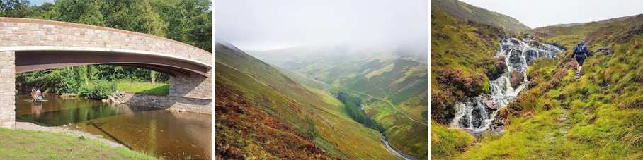
The Cumbria Way now heads downhill and off the fells into the pretty village of Caldbeck, which is about half way along our journey. Following the road across the river and out of the other side of the village, resisting the temptation of the various pubs and cafes is tricky! We still have a long way to go, so we must keep on running along the mixture of tarmac and grass paths, heading towards Dalston.
This section of the route is varied as it includes following paths, crossing fields and following the river at times. There are some lovely views that take your mind off the distance that you still need to cover. Soon enough, the common comes into view and the village of Dalston is just across the other side.
The last six miles is not as kind to tired feet. After leaving the village, by passing under the church archway and joining the cycle path that now becomes the Cumbria Way, most of the remainder of the route is on tarmac or hard track. It is, however, surprisingly tranquil as the path meanders alongside the river and trainline, gradually becoming more industrial as it gets closer to Carlisle city centre. There are a number of interesting bridges as the path winds between ‘out of town’ shopping centres and houses. With almost surprising suddenness, you arrive at the back of Carlisle train station, round the final bend and go ‘up and over’ the footbridge which takes you to Carlisle Castle – a stunning reward for your efforts!